The A.T. Guide (2016 Northbound)


 Reviewed by
denis daly
+1,024
 October 21, 2016
"The AT Guide" by David (Awol) Miller is one of the most comprehensive and easy guides I have used. The guide lists services to get you to Georgia and local hostels and services to get you home from Maine. It lists the water sources and has detailed maps of towns for resupply and rest. It also lists shuttle suppliers and outfitters to exchange or repair gear. Kennels close to the trail are listed for those with hiking buddies..
It's revised yearly because costs change from service providers. It's an all-in-one guide.
Pros
- Easy to use guide
- Hostels and cost
- Mileage and name of shelters along the trail
- Water sources
- Viewpoints
- Services and town maps and cost of some services that offer a discount to hikers
- Kennels close to the trail for those hiking with the four legged friend.
- ATM locations
Cons
- Profile shown is not 100%
- Some services change during hiker season and may have closed.
Disclaimer: This is the 2015 version and services change yearly and release of the guide is January of each year.
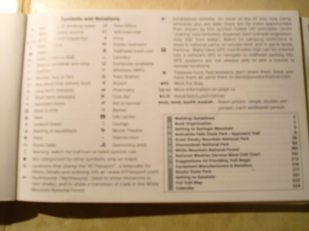
The AT Guide has a Symbols and Notations page. This page shows you the symbols for water sources and seasonal water sources, campsites, shelters, hotels, hostels and flora, view points, camera photography spots.
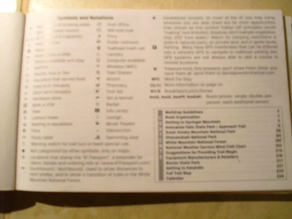
Symbols for post offices for maildrops and symbols for services can be found on the first page.

The second page is about the guide and mail drops and how to address them.
They also list their website so you can check on trail updates during your hike. Some services change due to the proprietors of a business and discounts that were listed may have changed. The guide also tells how to dispose of waste properly and gives a data spread (Table of landmarks and mileages and elevations). Services spread (resupply information and businesses are selectively included).
The guide also gives tips on trail etiquette and town etiquette. 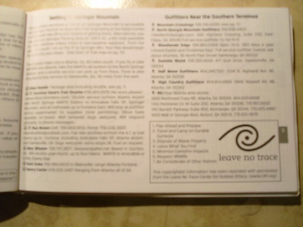
Getting to Springer Mountain is listed and close services such as shuttle providers and outfitters closest to the terminus. Leave No Trace principles. I thought adding those would help new hikers and refresh experienced hikers.
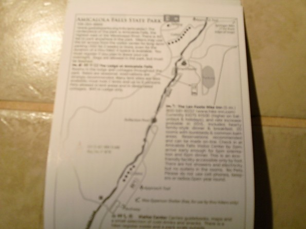
Layout of Amicalola State Park and close services and cost of parking and the park's phone number.

This is the start of the trail. Mileage 0 shown is the mileage of the shelters. It also shows the profile and elevation to the right. A parking location. You'll find the symbols to the right on each page.
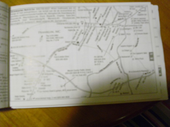
One of the maps detailing a town and services with symbols

Listing of services or hostels, phone numbers for providers are on a page before a town

Calendar at the end of the guide gives you a listing and dates of festivals and hiker Rucks that take place during the calendar year near the trail.
Where to Purchase:
- www.theATguide.com
- Amazon
- hiker hostel in Dahlonega, Georgia, carries a small supply
- Shenandoah National Park Visitors Center Book Store
Formats: Book version, loose leaf book version, and PDF download which can be found on their website
Summary: I buy the guide biannually for me and look at the updates on their website for services that may have changed and add them to my guide. I found this the easiest guide of any I have seen. It's set up from beginning to end for any user regardless of experience.
I am buying the latest for 2017 because some businesses have changed and part of the trail has been rerouted and the mileage has changed. But I highly recommend this guide to anyone that is thinking of a thru hike or section hiking. For those thinking of hiking southbound there is a southbound addition with the same formats.
Source: bought it new
Price Paid: $15.95
Your Review
Where to Buy
You May Like
Specs
| Price |
Historic Range: $15.95 Reviewers Paid: $15.95 |