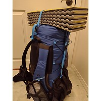
Garmin inReach Mini 2
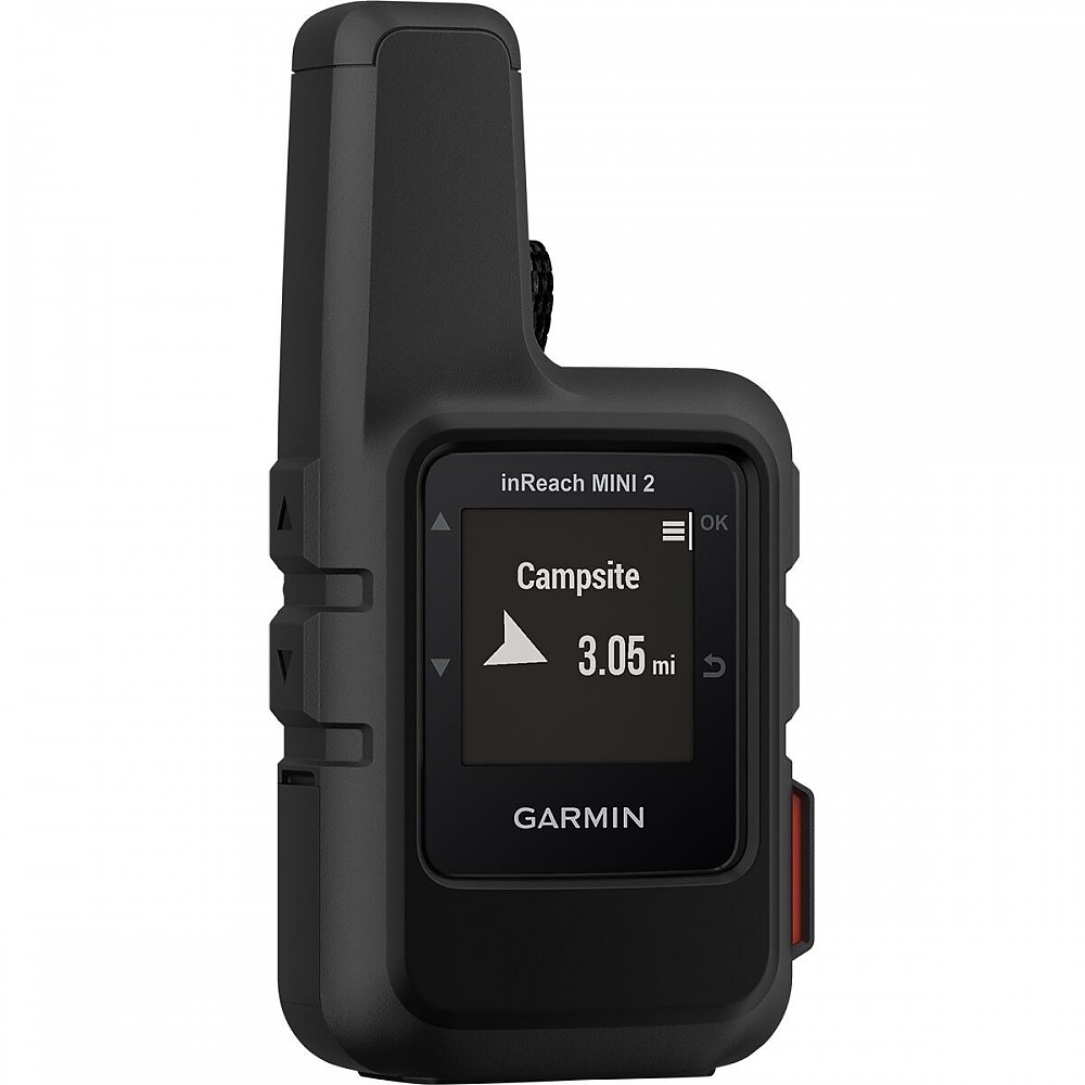
A two-way satellite communicator and potential life saver for whenever things go sideways anywhere outdoors. Send and receive messages and track points, get weather reports, follow a planned track or backtrack, send an SOS, all in a 113 g /4 oz device that fits in the palm of your hand. Control using a Bluetooth app makes using it a lot easier. Navigation functions are somewhat limited.
Pros
- Small and light
- Long battery life
- Keeps folks back home informed of your whereabouts and movements
- Send and receive text messages
- SOS call to 24/7 response center for when the dung really hits the fan
- Get weather forecasts anywhere in the world
- Can be linked to a cell phone to make texting and using other functions easier
Cons
- Requires a subscription with additional charges for tracking and messages over monthly limit
- Navigation functions very basic
- May be eclipsed by satellite-capable cell phones (when battery life not a concern)
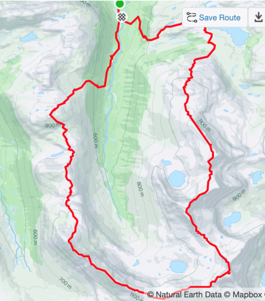
A couple years ago I went on a long, mostly off-trail solo hike over a series of summits on a horseshoe-shaped ridge around the head of a valley, involving some exposed scrambling to get around an obstacle on a sharp ridge. I had a signal on the last major top so I called my wife to let her know that I was headed down and should be home in 3 or 4 hours. There was one more minor top that I could have skipped, but I decided to add it in because it would only add a couple kilometers.
Wrong.
It took a lot more distance and time because I wanted to stay off some steeper terrain and I got into some rollercoaster terrain and light bushwhacking. The weather deteriorated and my cell phone was dying and I kind of needed it for navigation and didn’t have much of a signal anyway.
Long story short, I got down to the car a couple hours later than predicted, my wife got worried and called the police, who then called me as I was driving out and finally got a signal so I was at least able to defuse the situation. But my wife was still mad at me for being a selfish idiot, which I was.
We bought an inReach Mini 2 not long after that.
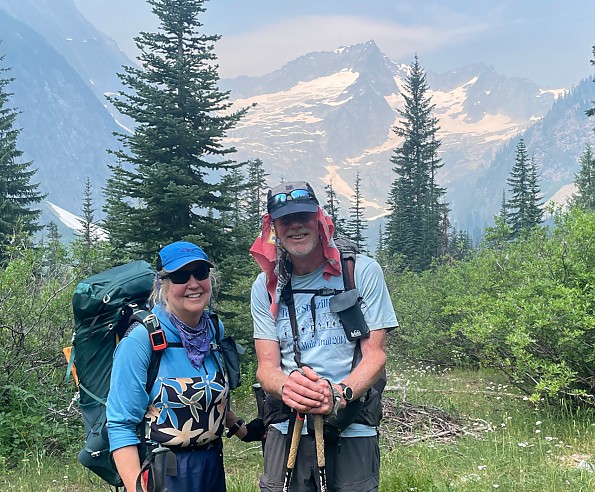
Cut to summer 2024. Day 5 of a planned 12-day hike in the North Cascades. Plan for the day: our friend Neal would meet us at a road crossing with a resupply box and maybe spend a night out on the trail with us before heading back to work at a nearby outdoor education center. We had an early but leisurely breakfast, then hit the trail. Not much more than a mile into the day, the inReach buzzed:
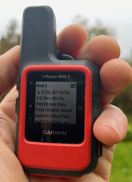
We had an extra meal and probably enough other calories and coffee to get through another night and day, but no more. We checked the map and came up with an exit plan that would get us out with one more night. Here's more of the exchange, resurrected via the Garmin Messenger phone app:

The cavalry (Neal and his girlfriend) reserved a campsite and “rode” in over Cascade Pass with some food. We camped together and all hiked back over the pass the next day.
That evening, another fire started above the Cascade road, resulting in its closure. One day later and we would have really been FUBARed.
Those two anecdotes illustrate the need for and utility of the inReach Mini 2.
What it is

The inReach Mini 2 (from now on I'll just call it an inReach) is a small, handheld satellite communication device that can be used to:
- send simple check-in messages
- send and receive short pre-written or typed-in text messages
- send tracking points to a cloud server so that folks with a link can follow your progress
- get condensed weather forecasts
- record tracks and waypoints
- follow a preplanned route or backtrack
- in the event of an all-out emergency, send an SOS to a 24-7 emergency call center that will initiate a rescue
That’s a lot in a small package! —113 g (4 oz) including a ‘biner to hang it from a pack strap and almost small enough to hide in one (big) hand. It is rainproof—Garmin says it will survive immersion at 1 m for 30 minutes.
Ain’t no free

Using the inReach isn’t free. As it reminds you every time you switch it on, you need a subscription to use it for anything more than flipping through the screens. Garmin has just updated its service plans but will allow us to continue on our current Annual Contract Safety plan for the time being. It costs us $11.95 (about NOK 120) a month, allows for unlimited check-in messages and SOS messaging, 10 text messages a month, charges 10 cents for each tracking point with live tracking and $1 for additional text messages and weather reports. Additional text messages beyond the monthly limit cost $1 each. Last year we ran up a pretty hefty bill live-tracking our 25-day hike on Sweden’s 450 km Kungsleden, and subsequently cut the tracking interval from 10 to 30 minutes, but still consider it all worth it, especially when I go solo but also to keep family and friends informed as needed.
At $14.99 a month, the updated Essential Safety plan will give us 50 free text messages and introduces voice and photo messages via a phone app connected to the inReach, but no other changes. It will allow us to switch on and off monthly instead of paying year-round. I’m likely to head out on solo or group mountain ski tours now and then during the winter, so we’re sticking with the annual plan for now, but will probably go over to the new plan befor our next long hike.
Battery up!
The internal, rechargeable Li-Ion battery has a long life, but that still depends both on how you use the inReach and the environment you use it in. With trees overhead, even the small birch trees here in the Norwegian valleys, it can take a while to lock on to enough satellites to find itself, and it works harder to maintain contact, both of which consume battery life.
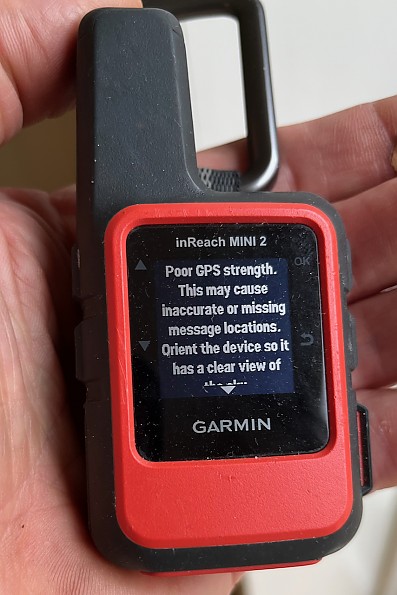
With a 10-minute tracking interval and no trees, Garmin says the battery can last up to 14 (8 hour?) days, but only 4 days with moderate tree cover. Cutting the interval to 30 minutes will get you 30 and 10 days, respectively. On our 25-day hike on Sweden's Kungsleden trail, we never ran the battery out or even very low because we had a backup battery and occasional access to the grid to keep it topped up. It was often still at over 80% after two or three days in mostly open country.
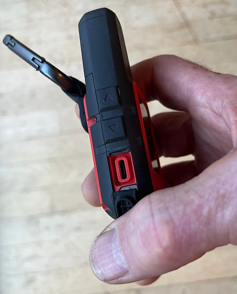
The battery is charged via a USB-C port under a water-resistant rubber seal on the left side, which takes a fingernail or impromptu tool to pry open.
Next-gen cell phones like the iPhone 16 may be satellite ready, but will not offer anywhere near the same battery life (and weigh a lot more).
The inReach OS
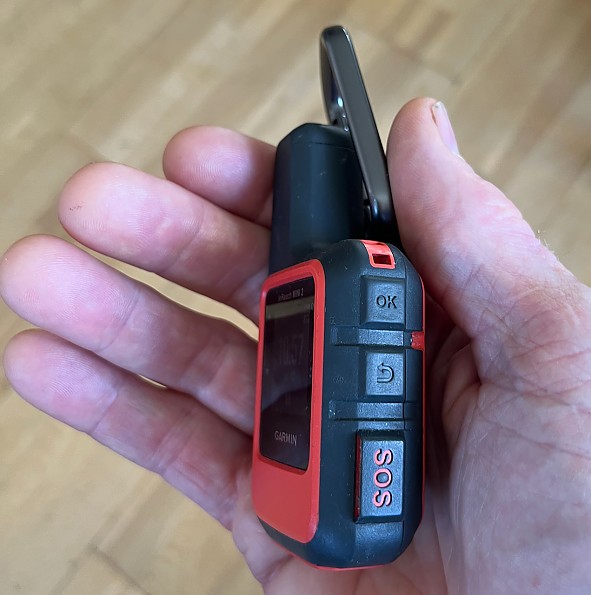
Like Garmin’s older handheld GPSs and watches, the user accesses the inReach’s functions via a series of menus and submenus using four buttons, two on each side, with the general roles of “up”, “down”, “OK”, and “go back”.

Unlike, say, my camera, which has hundreds of options, the overall system on the inReach is simple enough that it’s relatively easy to learn and remember where (at least the most important) options are.
Scrolling directly from the home screen gives quick access to five “widgets” (Garmin’s terminology): message history, tracking on/off, navigation info, weather report, message check. Choosing the menu with a click on the OK button delivers the full menu of inReach functions.

“Send message” is the first option on the main menu, and one of the most important for those of use trying to keep loved ones and friends informed of our whereabouts. Scrolling down through the contact list to check off recipients, many listed twice by both email and cell phone, and then back to the top to proceed to the next step, takes a lot of button pushing but gets the job done, You can then choose from among a short list of ready-to-go messages like “I’m starting here” or “I’m having a great time” (for some reason “I’m exhausted” or “This weather sucks” aren’t on the list), or choose to type in a message.
I (or my wife and I) send out the “I’m starting here” message to our daughters and others who might need to know (i.e. my wife when I go solo, or Neal as in the above) when we set out in the morning, turn tracking on so they can follow our progress, and send out and “I’m stopping here” message before shutting down at the end of the day.
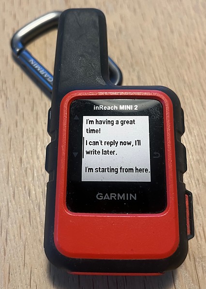
But I just discovered that the pre-written messages count as part of your text message allotment for the month and don’t achieve much more than the free check-in messages, so in the future we’ll probably use the check-in messages accessed via the next option on the main menu. The three standard check-in messages amount to “I’m OK”, “I’m starting my trip”, and “I’m ending my trip” and include position at the time of sending.

We also usually turn on tracking so our "fan club" can follow our progress and know where to look if we don't make our destination. With a thirty-minute interval between tracking points, that costs us a few hundred kroner or a few dollars a day, but our daughters tell us they really like being able to check in on us.
Two apps and a web site
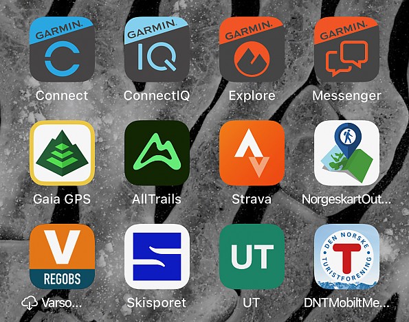
It takes two smartphone apps to fully drive the inReach via a Bluetooth connection: Explore and Messenger. Explore coordinates across multiple Garmin devices and will download maps, allow planning and uploading routes, and access the user’s library of contacts, messages, tracks, routes, waypoints, etc. as stored in a cloud account. It also handles account management.
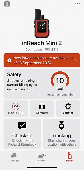
For more inReach- (or other device-) specific functions such as tracking and messaging, including weather forecasts, Explore bounces you over to the Messenger app, which can also connect independently and overlaps in various ways with Explore.
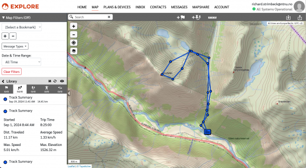
As a third leg, all the cloud info can also be accessed and edited on the Garmin Explore web site, probably the tool of choice when it comes to drawing routes on a bigger screen with a mouse or trackpad. This three-way approach is a bit confusing at first, but works well enough once you understand the relationship between the components. These apps may be worthy of separate reviews in their own right, but for now let’s just say they make life with the inReach a lot easier, especially when it comes to messaging.
Sending pre-scripted messages on the inReach involves a certain amount of button-pushing but is easy enough overall. But with no keypad, writing text messages is slow and laborious, scrolling to pick out one letter or symbol at a time. With the Messenger app you can choose message recipients, thumb-type or finger-peck messages, weather forecasts on your mobile phone screen, add contacts, change settings, and do all the other things much more easily.
Whither the weather?
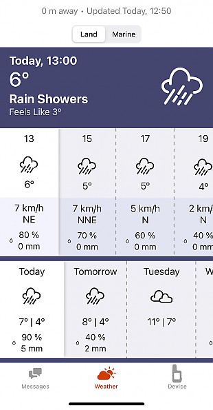
The inReach can request and receive a weather forecast for (presumably) anywhere on the planet. According to the Garmin FAQ, terrestrial forecasts come from Meteoblue, which finds the weather for the nearest station and then adjusts it for differences in location and elevation. Forecasts for marine locations come from OCENS and include wave height, current, and visibility information. The forecasts cover 8 days, with 2-hour intervals for the first two days and daily summaries for the remainder.
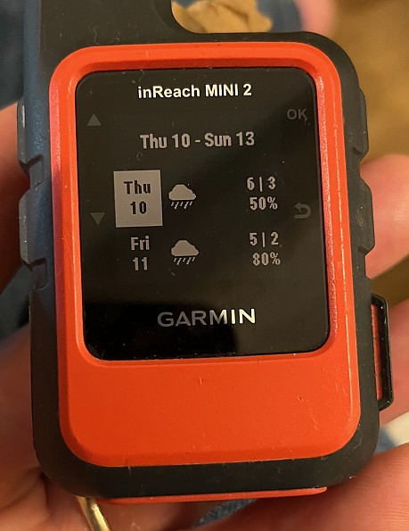
They use the usual array of weather icons with additional temperature, wind speed and direction, humidity, and precipitation numbers, in black and white on both the inReach screen and the Explorer app. A forecast counts as a text message for billing purposes. There’s some lively discussion online about how good these forecasts are, especially for mountain locations. I haven’t compared with my favorite service, Yr from the Norwegian Weather Service, but hopefully they are at least similar and better than nothing.
Navigation
The inReach offers some basic navigation functions. You can plan and load a planned route or call up any tracks that are stored on the device. In both cases these are displayed as simple lines on the screen, with any waypoints you may have recorded or transferred, not no map or landmark info.
There is a compass screen. The compass can be calibrated and a bearing set as needed.

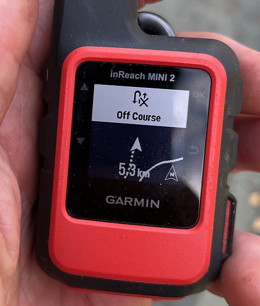
Whenever the inReach is on, it logs your track internally at 1-minute intervals, so that if you get lost in the fog you can call up the backtrack function, cleverly named TracBack, which uses a directional arrow and warning beeps to keep you on track. I tried this out by talking a 2 km out and back walk on the trails near my house, taking an alternate route for one stretch on the way back. When I got about 50 m off track, it gave a pleasant cricket-chirp and displayed an off course message. As I got further off track, the map zoomed out to keep showing the outbound track as a solid line and the return track as a dotted line, enough info to get back on track.
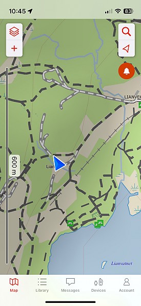
The Explore app can draw on various sources for downloadable maps and satellite imagery for some areas, with the best coverage in the US and Canada. For Norway I can only get Garmin’s own TopoActive maps. The TopoActive road and trail and other details in my immediate area are literally FUBAR.
I can get much more accurate maps using the Norway-specific Norgeskart Outdoors app.
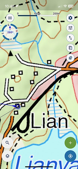
Being able to download maps to a phone to link up with the inReach is all well and good, even when the maps are of better quality, but smartphones have built-in GPS, and there are plenty of other nice map navigation apps like Norgeskart, so using the inReach in that way seems redundant at best.
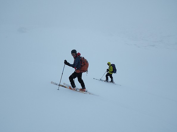
While the inReach may not be a preferred choice for a primary navigation tool, both following a planned track and being able to backtrack could be very useful, for example, in a white out on a hut-to-hut ski tour here in Norway, especially where the route crosses frozen lakes or other flat terrain (been there, done that, but not with the inReach). It might also help keep a user away from steep drops on mountain tours, provided that track is set back from hazards within whatever error tolerance the device offers. These functions could also be useful in poor visibility on a kayak or other boat outing. But in all these cases it would be better to have a device that can display detailed map info, such as a handheld GPS with maps or a phone with a suitable app. The inReach then becomes a backup, but potentially a valuable one because of its long battery life.
SOS
I’ve never used the SOS button, and hope I never have to, but it’s there if I need it. It has a protective cap that is easily levered open. I obviously haven’t done this, but if you press and hold the button the inReach will send an alert and your location to the Garmin Response center, which will then forward the information to emergency responders in your region to initiate a rescue. You can follow up with a pre-written or typed-in text message to add details about your situation; in the latter case, linking up via the Explore app would be a big asset. You can continue to exchange messages with the response center to keep both parties informed about what’s going on. The inReach continues to send a location to the response center, every minute for the first 10 minutes, then every 10 minutes thereafter. You can cancel the SOS by pressing and holding the SOS button again, then choosing “Cancel SOS”.
Word
The gripping 2023 book “Hidden Mountains” by Michael Wejchert tells the story of two couples attempting an unclimbed peak in a remote mountain range in Alaska. One of the climbers was badly injured while on lead and out of sight of his belayer. The ensuing and ultimately successful rescue was initiated by an older model inReach (then produced by DeLorme) SOS call. I have no plans to do anything that far out, but there is always some risk of accident and injury in any outdoor activity. Now that we have invested in an inReach, it seems downright stupid not to use it just about any time we or I are out of cell range, especially when I go solo.
As someone who in his young and foolish early life would head out alone on summit scrambles or multiday hikes without telling anyone where I was going, I might have been inclined to dismiss an inReach or even a cell phone as Too Much Technology Harshing My Wilderness Experience. But now I’m a responsible husband and (grand)father and I’ve been lost in a whiteout, cliffed out on a scramble, or hooked a ski tip on a tree enough times over the years to have a deep appreciation for how some honest communication could have bailed my *ss out more than once. Even without the navigation functions, the inReach is a potential life saver on any even moderately substantial outdoor trip. By keeping my wife informed of my whereabouts when I'm up on some ridgetop, it may also help save my marriage.
Background
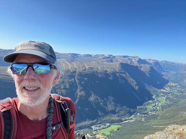
I have used handheld GPSs for about 20 years and phone map apps for about 10 years. This is my first satellite communicator, used to keep family and friends informed on a 25 day hike and, more importantly, to deal with a fire situation that terminated a planned 12 day hike.
Source: bought it new
Price Paid: About NOK 3300 ($330) including 25% VAT
Your Review
Where to Buy
You May Like
The inReach Mini 2 replaced the Garmin inReach Mini.
Specs
| Price |
MSRP: $399.99 Current Retail: $399.99-$400.00 Historic Range: $299.99-$400.00 |
| Weight |
3.5 oz / 100.0 g |
| Dimensions |
2.04 x 3.90 x 1.03 in / 5.17 x 9.90 x 2.61 cm |
| Water Rating |
IPX7 |


